| |
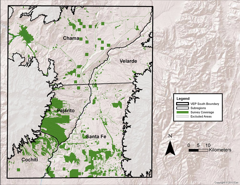
Subregions of the VEP South Study Area
The VEP South study area was divided into subregions to estimate population size with greater accuracy and to examine how population shifted within the larger study area through time. This map illustrates the boundaries of the five subregions and the archaeological surveys that located and documented archaeological sites. These surveys included block surveys and linear transect surveys. The survey coverage—ranging from highest to lowest—in each of the subregions is as follows: Pajarito 40 percent, Cochiti 21 percent, Santa Fe 20 percent, Chama 8 percent, and Velarde 3 percent.

Map by Crow Canyon Archaeological Center (base map imagery by ESRI) |


