Crow Canyon Archaelogical CenterWashington State University


  Question 7      supporting material
 

Subregions of the VEP North Study Area
The VEP North study area was divided into subregions to estimate population size with greater accuracy and to examine how population shifted within the larger study area through time. This map illustrates the boundaries of the six subregions and the archaeological surveys that located and documented archaeological sites. These surveys included block surveys and linear transect surveys. The survey coverage ranges from a high of 100 percent in the Mesa Verde National Park subregion to a low of 5 percent in the Mesa Verde Landform subregion. The survey coverage for the remaining subregions was as follows: Ute Piedmont 23 percent, McElmo 20 percent, Hovenweep 18 percent, and Dolores 18 percent.
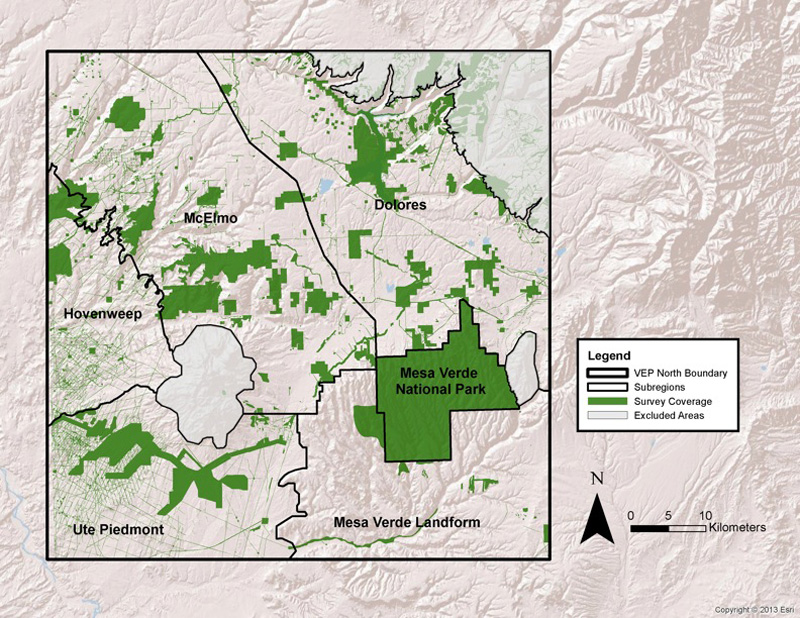
Map by Crow Canyon Archaeological Center (base map imagery by ESRI)


The Village Ecodynamics Project Major Partners


Our Mission
The mission of the Crow Canyon Archaeological Center is to advance and share knowledge of the human experience through archaeological research, education programs,and partnerships with American Indians.

Crow Canyon is a 501(c)(3) not-for-profit organization.


Copyright © 2015 by Crow Canyon Archaeological Center. All rights reserved.
Designed and maintained by Aztec Media Corp.

National Science Foundation Mesa Verde National Park Bandelier National Monument National Park Service Denver Museum of Nature & Science National Geographic U.S. Forest Service Santa Fe Institute Bureau of Land Management - BLM School for Advanced Research Wayne State University Colorado Office of Archaeology and Historic Preservation Canyon of the Ancients National Monument University of Windsor University of Norte Dame New Mexico Historic Preservation Division